This section establishes a minimum vocabulary necessary to begin to interpret the air photos upon which this module is based. These air photos form the basis for defining the three dimensional geometry of relatively homogeneous layers, strata, or lenses of rock or soil.
Layer boundaries and variability are necessary to establish the prior geologic model. Both geologists and soil mechanicians will find discussion in this section overly simplistic: however, it should be remembered that the goal of this module is to identify in detail three dimensional depositional environments to assist in the development of appropriate three dimensional boundaries of subsurface layers/lenses/strata. Geostatitcians call this stage in model development: establishment of the prior model. The prior is the initial model, which must be hypothesized in order to begin quantitative evaluation of the exploration and characterization process. The more "informed" is this prior, the more valuable will be the use of geostatistics in the design process.
I. Topographic Features
Topography is most diagnostic for interbedded sedimentary rocks, where the topographic highs are controlled by the most erosionally resistant rocks: sandstones in humid climates and sandstones and limestones in arid climates. Topographic lows are composed of limestones and shales in humid climates and shales in arid climates. The topographic features and layered geometry produces discernable patterns. These patterns and their 3 D representations are given with their respective structural complexity in the rock section. Generally, transported soil deposits contain too little topographic relief for topography to play a diagnostic role. Structural geometries for rock deposits are as follows: in order of increasing complexity
Horizontally bedded
Tilted
Folded
Faulted
II. Drainage Pattern
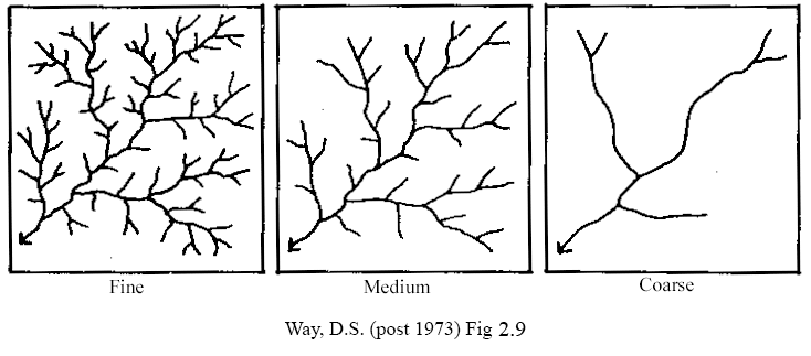
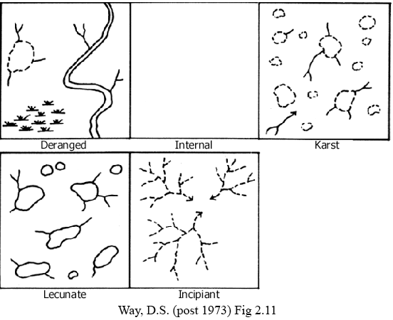
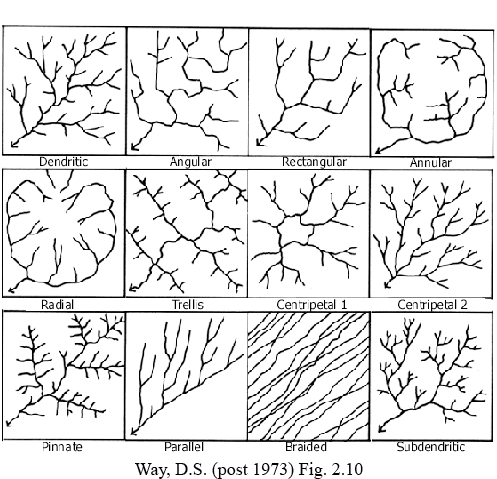
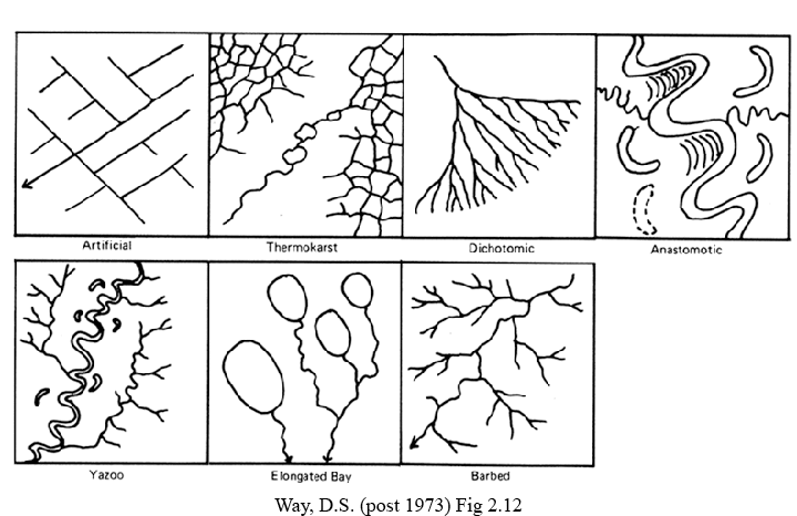
Drainage Patterns are most important in identifying rock deposits and shallow residual soil deposits where drainage is controlled by the overall structure or the near surface rock joints. Figure A1a shows three different drainage densities. FigureA1b, FigureA1c, and FigureA1d show collections of nonintegrated, integrated, and miscellaneous drainage patterns, respectively, and the associated rock type.
III. Drainage Density
There are three densities of drainage
Dense
< 6 mm between pathways in 1:20,000 scale photo
Dense drainage occurs in impermeable deposits such as clay tills and clayshales
Medium
Coarse >40 mm between pathways
Coarse drainage occur in permable deposits such as sands and above rocks
whose residual soils are permeable
such as sandstone and quartzite.
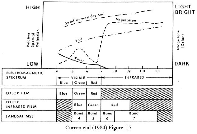
IV. Relative gray tones in photos
A.
Based upon reflectivity. See Figure
A2
B. Dry materials more reflective than moist
C. All things being equal
1.Wet and poorly drained materials have darker tones
a. silts and clays
b. organic soils
c. bedrock lows
2.Dry and well drained materials have lighter tones
a. sands and gravels
b. topographic highs
D. Light minerals are more reflective
1.Light
a. silica sands and sandstones
b. most limestones
2 Dark
a.ferro-magnesian minerals
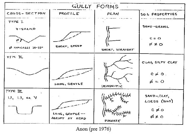
V. Gully Type
Gullies are relatively short (a few 100's of m long) intermittent drainage ways. Their shape and tonal texture provide clues for discerning soil type. Length of drainage pathway, slope of pathway, and crossection shape are important diagnostic characteristics. These characteristics and the associated soil type are shown in Figure A3 and outlined below.
1. Sand:
short & "V" shaped
2. clay :
long, winding and "U" shaped
3. silt(loess):
long, box shaped in plan and cross section
VI. Identification of Transported Soil Deposits
Transported soil deposits are identified by first identiing the landform of the deposit. Once the landform is identified, then soil types can be located with a combination of the variation of fluid velocity within the landform and detailed analyses of gray tones, gray tone patterns and gully patterns and shapes. Details of this approach are beyond the scope of this set of notes, but can be obtained by taking a course in Air Photo Identification such as that offered at Northwestern University.