This section introduces the rudimentary concepts for an understanding of geostatistics. The geostatistics module should be consulted for a more detailed and mathematical presentation of these concepts.
I. Autocovariance
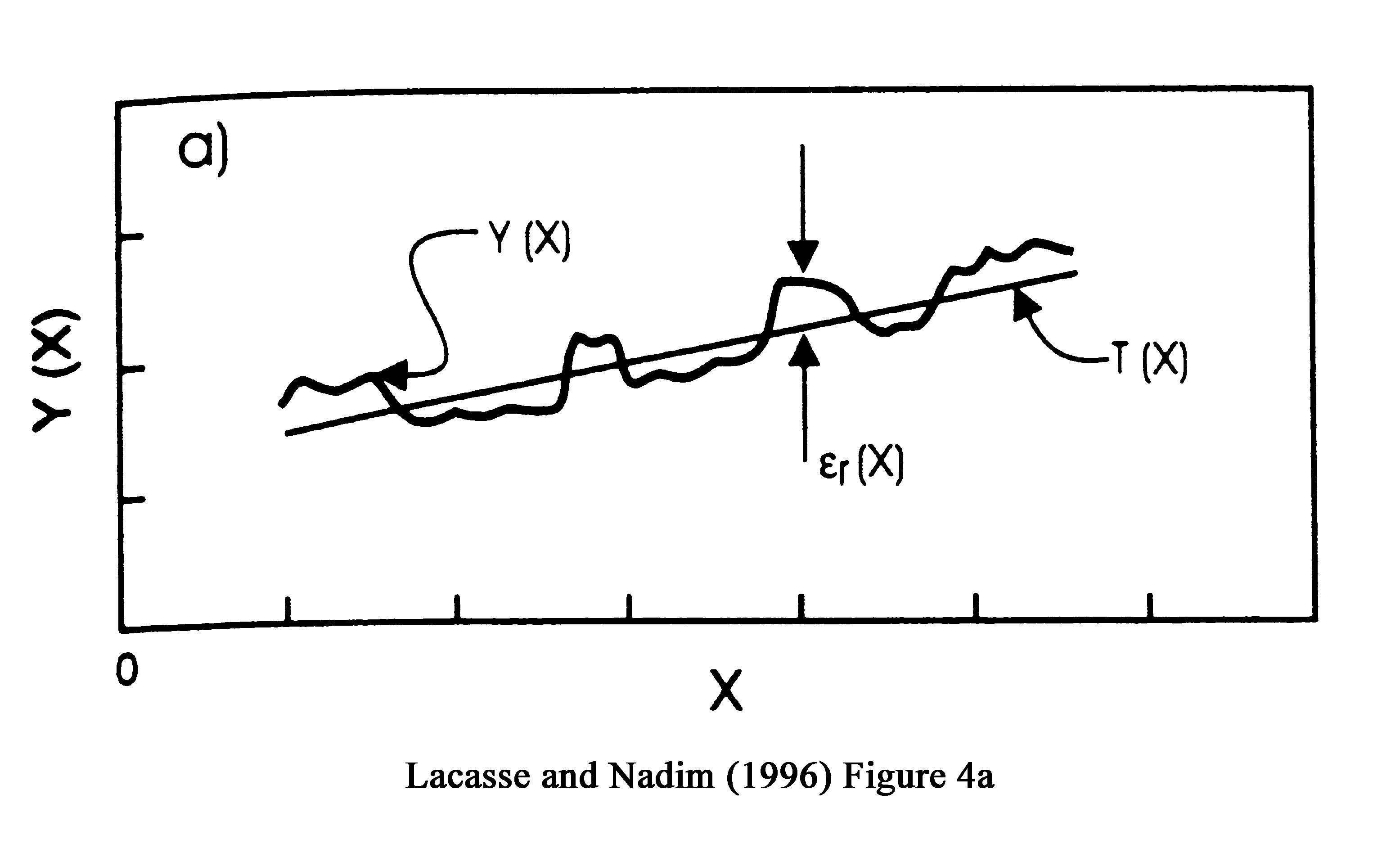
A. Figure
B1 shows variation of a property, Y, along a line
B. If the trend, T, is subtracted from the data,
the residual, epsilon, remains
C. Plots of the normalized square of the residuals,
sigma squared, against the distance between residuals
(the lag distance, r) are
the autocovariance function. As shown in Figure
B2, this function may have varying shapes,
but in general it declines
with distance.
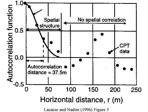
D. Figure
B3 shows an auto correlation function for cone penetration resistance
at a particular elevation for
17 different probes.
No correlation or spatial structure beyond 75 m
Autocorrelation of 0.33 = autocorrelation distance
II. Variogram and Kriging
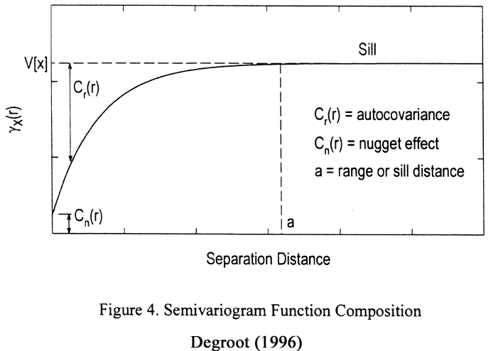
A. As shown in Figure
B8, if one minus the normalized residual squared is plotted vs the
lag distance,
the variogram is developed.
B. The variogram and the
autocorrelation function are equal to one minus the other.
C. The variogram is associated
more heavily with geostatistics.
D. As shown in Figure
B4, the distance at which the sill is reached, the range,
is the limit of spatial structure.
E. The intercept or nugget
is the variance at the sample point.
III. Limit of Spatial Structure
A. As can be seen from
Figure
B8, either approach can be employed to determine
the distance out to which properties are correlated in space.
B. The two distances employed
in the limit of corrleation,
autocorrelation distance and range, are not the same.
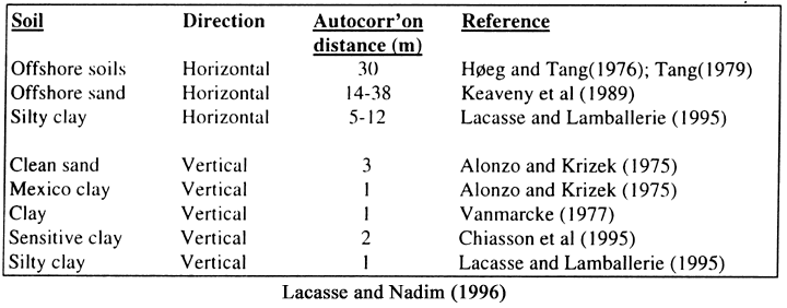
IV. Autocorrelation distances (AC) for differing deposits.
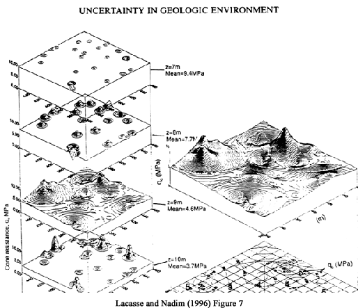
A.Figure
B5 shows variation about the mean for different depths of
penetration resistance in the North Sea. The horizontal autocorrelation
function
for depth 9m is shown at the bottom. It would have the least AC of any
layer
B. Table
B1 lists AC's for various deposits
C. As expected, there is
much less correlation in the vertical direction in soil than in the
horizontal direction.
D. The references should
be consulted to determine their geological origin for
clues as to the process of deposition.
E. As will be shown later,
gelogic processes control correlation.
For instance, one would expect
smaller horizontal AC distances for braided stream sands than for flood
plain silts